
Use of gvSIG for Protection of Cultural Heritage in the Lipetsk Region, Russian Federation
According to Russian legislation in the field of protection of cultural heritage a territory and a protected area of a cultural heritage object must be registered in the United register and the State cadastre. The procedure of the registration includes the process of preparing a spatial information for the passport of a cultural heritage object and the land survey documentation. In the same time the ordered and coordinated information about cultural heritage objects is required for the practical activity of the specialists in the field of protection of the cultural heritage. But as rule they have not any knowledge and software solutions to solve these tasks.
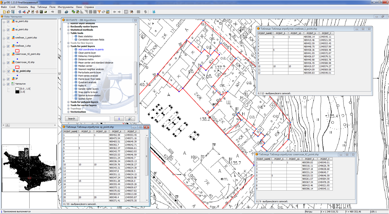
Authors of the presentation tried to find some solutions of those problems using the gvSIG Desktop and other open source geospatial software. It was developed the procedure of the preparation of required documentation according to Russian legislation. The gvSIG Desktop was used to form the boundaries of the territories and protected areas of cultural heritage objects. The example of the full registration procedure for the cultural heritage objects in Chaplygin town of the Lipetsk region is presented in the talk.
During 2011-2012 the gvSIG Desktop was also used to prepare a spatial information for more then 180 archaeological sites on the territory of the Lipetsk region. Now authors are developing the information system to support the archaeological studies in Lipetsk region. This system based on client-server architecture and includes the gvSIG Desktop as SDI client. The PostgreSQL/PostGIS is used as a database to store both attributive and spatial information on archaeological sites.
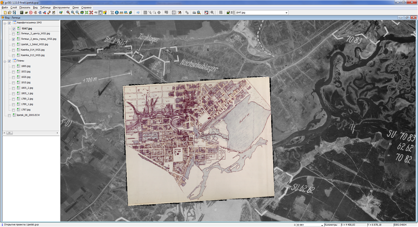
In addition to those projects in 2012 the historical geographical model of Lipetsk City territory was developed with the gvSIG Desktop. This model based on the set of historical large scale maps since 1787 till 1915 and the set of historical aerial photo coverages of 1942-1943. Using these data together with current spatial data sets we could to study a dynamics of the growth of the Lipetsk City territory and changing the tree areas during more then two centuries.
Use of the gvSIG Desktop and other open source geospatial software gave a practical techniques and instruments to everyday work of the specialists in the field of protection of the cultural heritage in the Lipetsk region. Authors are going to continue the development to make in result the full scale cultural heritage management information system based on the gvSIG and other open source geospatial software.