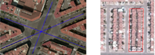
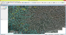
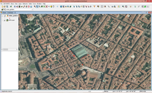
Skip directly to content

Recent Case Studies in English

Case studies by language: English · Spanish · Portuguese · French · Russian

41 case studies so far, why not contribute yours?

gvSIG in Russia: from Localization to Community

Sectors: 
Situation: 

Since the middle of 2000th the gvSIG became one of the popular open source GIS in Russia. But the absence of the Russian localization for the UI and user documentation delayed a spreading of the gvSIG in Russia.

5
Average: 5 (3 votes)
Country: 

Use of gvSIG for Protection of Cultural Heritage in the Lipetsk Region, Russian Federation

Situation: 

According to Russian legislation in the field of protection of cultural heritage a territory and a protected area of a cultural heritage object must be registered in the United register and the State cadastre. The procedure of the registration includes the process of preparing a spatial information for the passport of a cultural heritage object and the land survey documentation. In the same time the ordered and coordinated information about cultural heritage objects is required for the practical activity of the specialists in the field of protection of the cultural heritage.

Software: 
5
Average: 5 (3 votes)
Country: 

GIS open source framework for an interactive surface and groundwater modelling

Situation: 

The SID&GRID research project, started April 2010 and funded by Regione Toscana (Italy) under the POR FSE 2007-2013, aims to develop a Decision Support System (DSS) defined by a framework based on open source and public domain solutions for the planning and management of the water resource. Today, while some surface hydrological processes are embedded within GIS both commercial and open source, the groundwater modelling processes is not easy to find within geographical code and algorithm.

It will consist in watershed-scale model able to simulate surface and subsurface flow in a

Software: 
5
Average: 5 (2 votes)
Country: 

Bringing GIS to the masses using gvSIG – the use of free and open source GIS in community outreach at UNH Cooperative Extension

Situation: 

Communities throughout the state of New Hampshire desperately need GIS to improve community planning and natural resource management, but most balk at the high price of commercial software products. While ~10 towns in the state have full-time GIS staff, the 200+ other towns have little or no mapping capabilities in house. A capable, no-cost GIS software package is one of the only ways in which GIS has a chance to take root in these communities. Most towns in New Hampshire are unaware that free / open source GIS options exist.

Software: 
5
Average: 5 (5 votes)
Country: 

Definition of a Geographic Area Suitable for Growing Balsa on the Coast of Ecuador

Situation: 

Professionals to the Department of Forestry Development Company INMAIA S.A. have a basic tool for recommending technically the geographic location of their afforestation.

Software: 
5
Average: 5 (6 votes)
Country: 

Analisys of contaminants and salinity in the Minho's river for the European Project

Situation: 

The project TEAM-Minho, led by the University of Vigo, brings together scientific partners and water administrations on both sides of the river Minho to develop common tools for the coordinated implementation of the Water Framework Directive in its estuary.The aim of this project is the establishment of uniform scientific criteria, valid for Spain and Portugal, allowing the definition, referencing and classification of ecological status of transitional water bodies in southern Galicia and northern Portugal.

Software: 
5
Average: 5 (6 votes)
Country: 

gvSIG as a GIS tool for creating maps for senior citizens published by the City of Munich

Situation: 

Senior citizens in cities are often less mobile than younger persons and therefore not participating in social activities or getting enough physical exercise.

In order to promote their health and their participation in social life, maps specifically tailored to the needs of the elderly can be a valuable contribution to complement other health care activities.

Software: 
5
Average: 5 (8 votes)
Country: 

Asbestos extension: an advanced customization of NavTable that provides an assisted data entering for the asbestos surfaces status of the Autonomous Province of Trento

Situation: 

Ultimate goal of the “Dati Amianto” project is to enable the APSS (Azienda Provinciale per Servizi Sanitari) of Trento for the gathering of the data coming from the in-place examination of the status of asbestos surfaces (identified via MIVIS scanning) of the provincial territory.

The surfaces to analyse and their attributes are contained within a single shapefile (APSS sheet), logically divided into smaller parts and sent to every in-charge person.

The developed extension is thus required to provide a suitable solution for the municipal technicians for the:

  • displaying of the data contained
Software: 
4.6
Average: 4.6 (5 votes)
Country: 

WG-Edit: a new gvSIG extension for the street cadastre management

Situation: 
  • ArcView 3 is no more supported by ESRI
  • WgEDIT extension for ArcView3 is no longer supported
  • Avenue is an old language (it is difficult to implement new customizations)
  • The basic road network and the attributes of the roads are currently managed by two different technologies
Software: 
5
Average: 5 (3 votes)
Country: 

iter.GIS – Desktop based application to manage toponymy data among Tuscany Region

Situation: 

Regione Toscana founded a regional project named iter.net (http://www.iternet.fi.eng.it/SigmaPortal2) to set up a communication infrastructure that allows toponymy data transfer from Local Entities to Regione Toscana itself, using regional transfer infrastructure known as CART (http://www.cart.rete.toscana.it).

As a strategic component of such a design, Regione Toscana needed an application to enable Local Entities to manage road network and street numbers and to transfer updates through CART.

Software: 
0
No votes yet
Country: 

Pages