
gvSIG for managing roads information
Contact name:
Salvador Llorenç
Organization:
Conselleria de Infraestructuras y Transporte. Generalitat Valenciana
Department:
Centre de Gestió i Seguretat Viària (CEGESEV). Direcció General d'Obres Públiques
Sectors:
Software:
Other software:
Situation:
The main objective was to offer the geographical information available and develop a GIS for managing roads information.
Solution:
The geographical information is offered according to OGC standards.
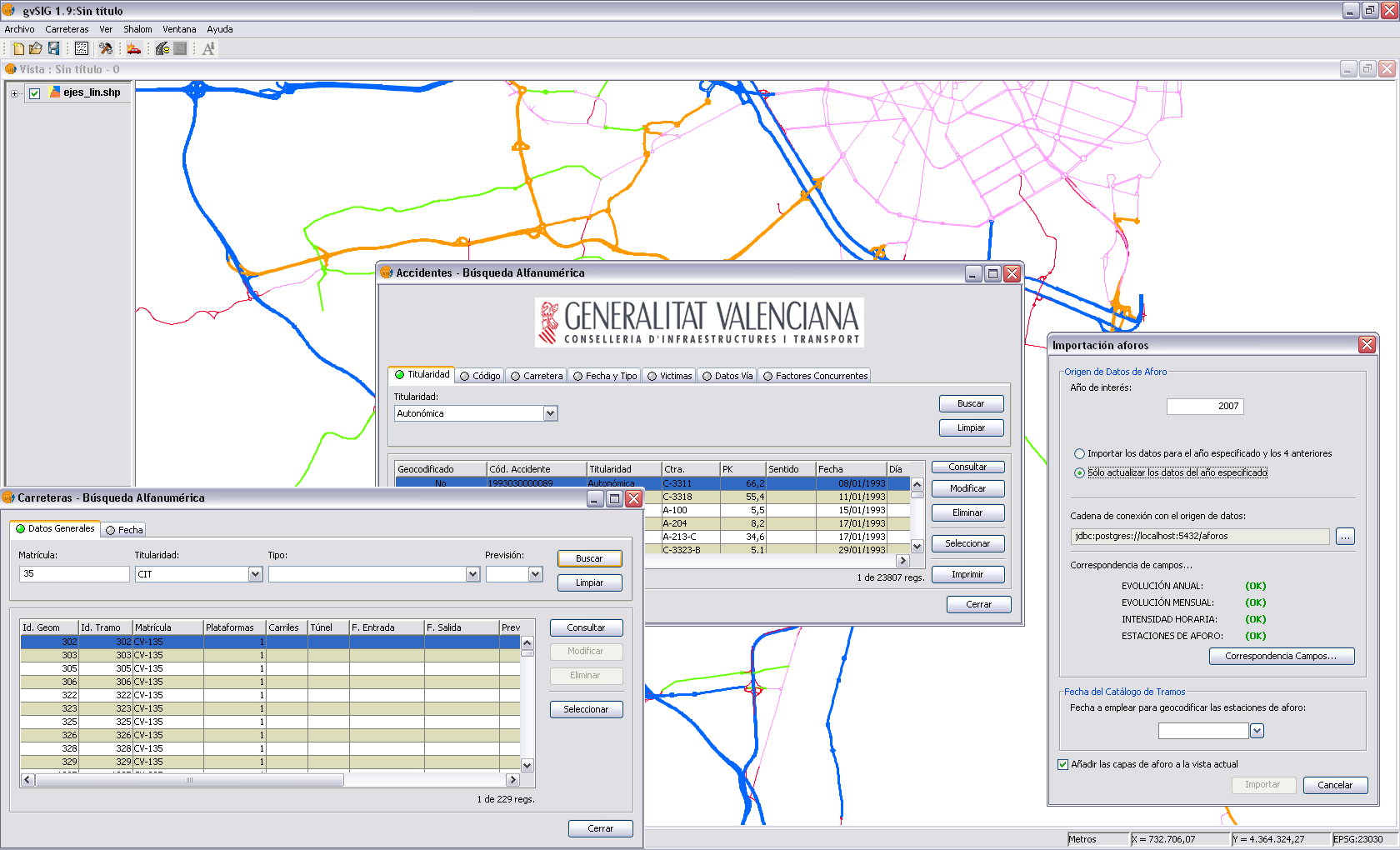
An adaptation has been developed on gvSIG. It allows to do these tasks:
- Georeferencing of databases based on dynamic segmentation of the road network.
- Management following the EuroRoads data model.
- Cartographic and alphanumeric editing, adapted to the road network data.
- Query of information related to administrative records.
- Import and analysis of traffic accidents data.
- Reports, predefined layouts, and creation of road sketches.
Benefits:
- Improvements at the road network management.
- The benefits of free software released under the GNU/GPL License.
- Better access to data and the benefits of working with spatial databases and Spatial Data Infrastructure (SDI).
Rate it!!: