
gvSIG applied to urban and territorial planning purposes
The main objective was to develop the Master Plan for the suburbs of a consolidated City's area, where new neighbourhoods needs to be established.
Initially we needed:
- An information system, which allows understanding and modelling the City's patterns expansion.
- Coprocessors, to link the information database through overlapping and buffering tools.
- A mapping system, to show and communicate in a friendly manner the findings and conclusions to the Local Government and the community in general.
Moreover, this project requires a long term scale of work. It's necessary to guarantee access to the information in a flexible and transparent manner for future Project's stages and different Local Government users.
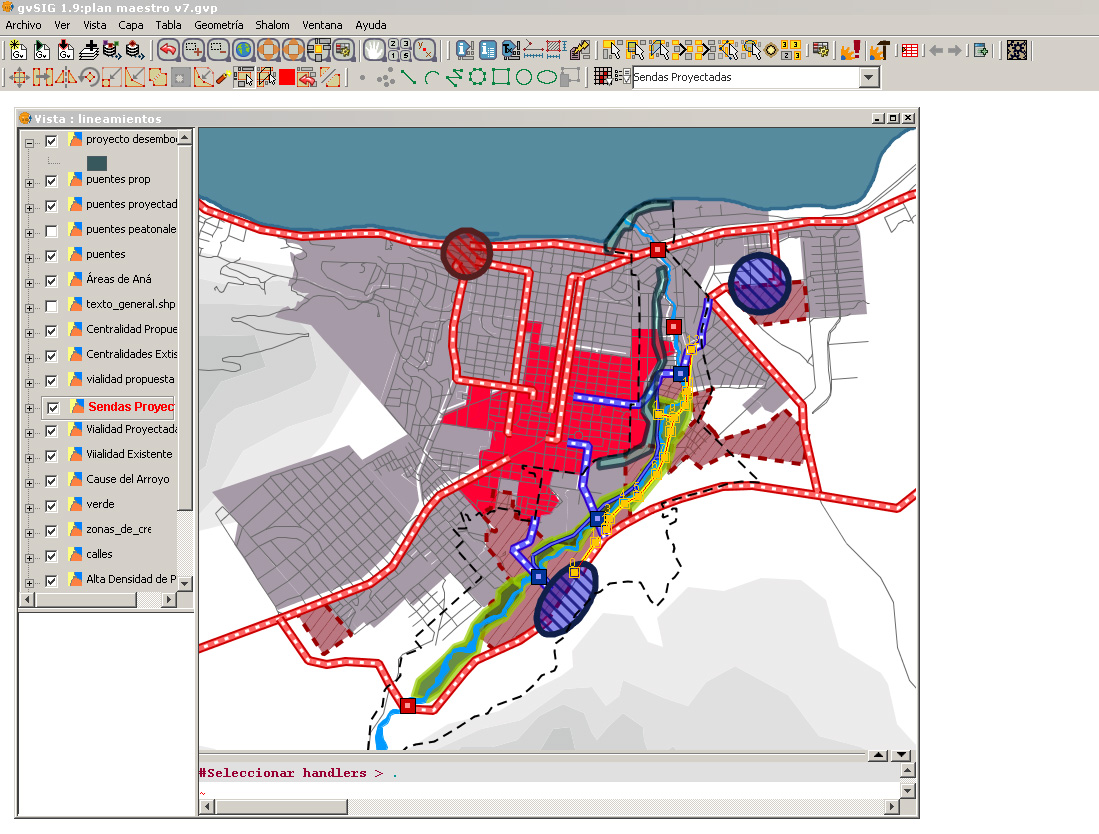
gvSIG was used:
- to re-project every piece of geographical data available to the same CRS.
- to display and map the available data. This allowed to organize and catalogue the data into an information system.
- to create a synthesis map, for resuming the available information. This allowed the experts to interpret the variables and request proximity and overlapping operations on the database information.
- to process the data according to the expert's request.
- to display maps with the processed and new generated data. Those maps were used by the experts to develop the City Master Plan.
The maps were developed to model geographical natural environment for the Master Plan's context, as well as, friendly maps as a new channel of communication with the community.
A special and more friendly interface, called “Juego de iconos TReCC 1.3”, was also developed. It's available at the gvSIG's unofficial downloads website.
Moreover, gvSIG was used as part of a Geographic Information System which was delivered for the City Government, allowing them to develop new analysis in the future.
This GIS' components are:
gvSIG
- development of a special interface software (Icons set)
- development of an Operative Manual for dummies
- data Set
- display spacial information through Maps
- Using free software, our cost were quite lower than using other kind of software.
- Using free software, we were able to develop our own platform for future studies' stages.
- Using free software, we were able to adapt and develop a more friendly interface, according to our costumer needs, simplifying the interaction and maximize the System's performance.
- gvSIG gave us a flexible, stable and functional environment to perform this project in time and according to the particular requirements of our customer, who is fully satisfied.