
gvSIG applied to the management of the agricultural lands of the Lipetsk Region
To take decisions in the management of territory, the governor of the Lipetsk Region and the Heads of the municipal districts need an information about current state of the agricultural lands and its use. As a rule, that information is existing in the form of the paper maps and schemes, it's awkward in the daily work and doesn't reflect the real situation.
These problems was solved by development of the regional information system for the monitoring of turnover of the agricultural lands on the territories of the municipal districts of the Lipetsk Region. The system was developed in November and December 2010. Its main feature consists in that it's fully based on the open software including open geospatial technologies and program products.
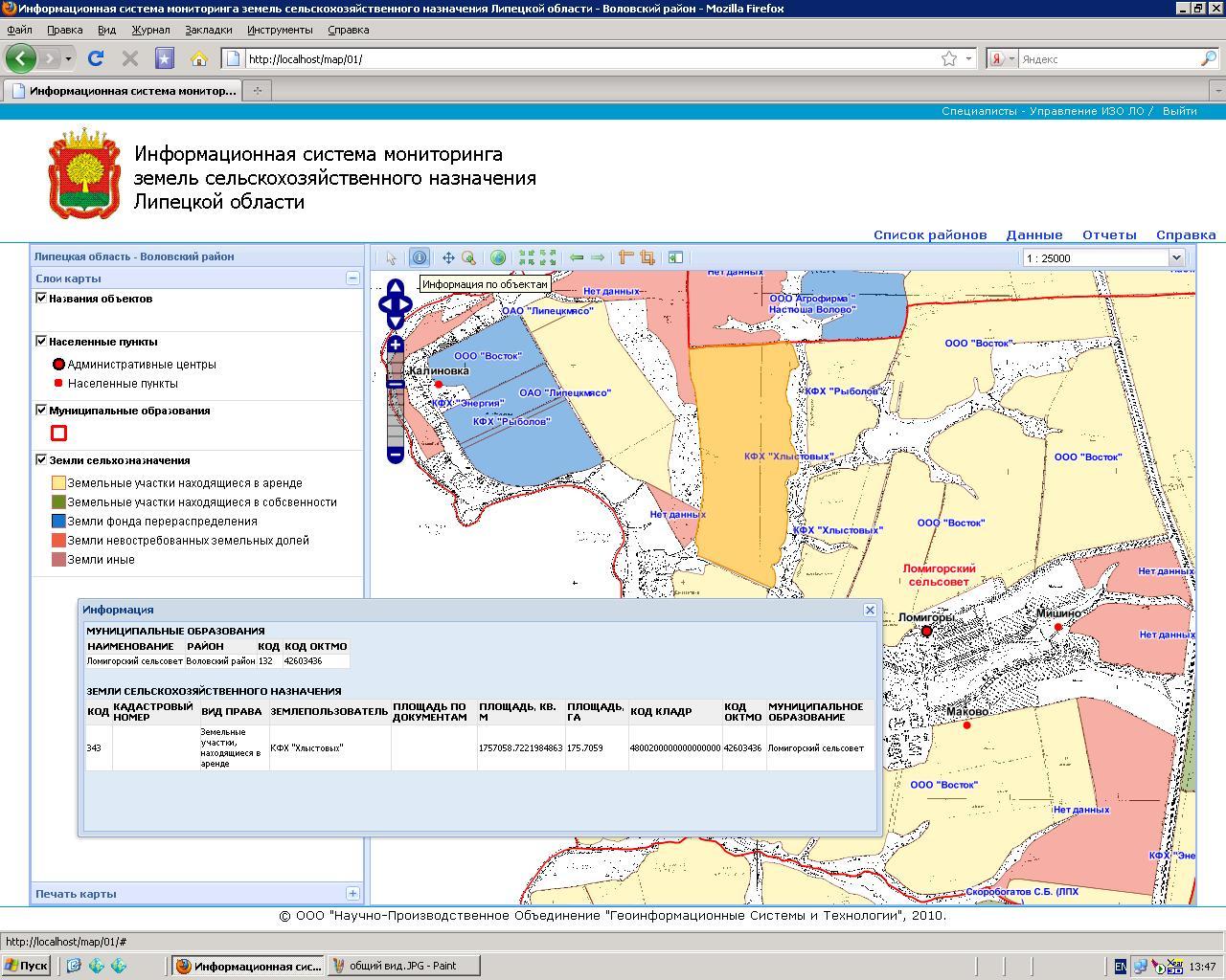
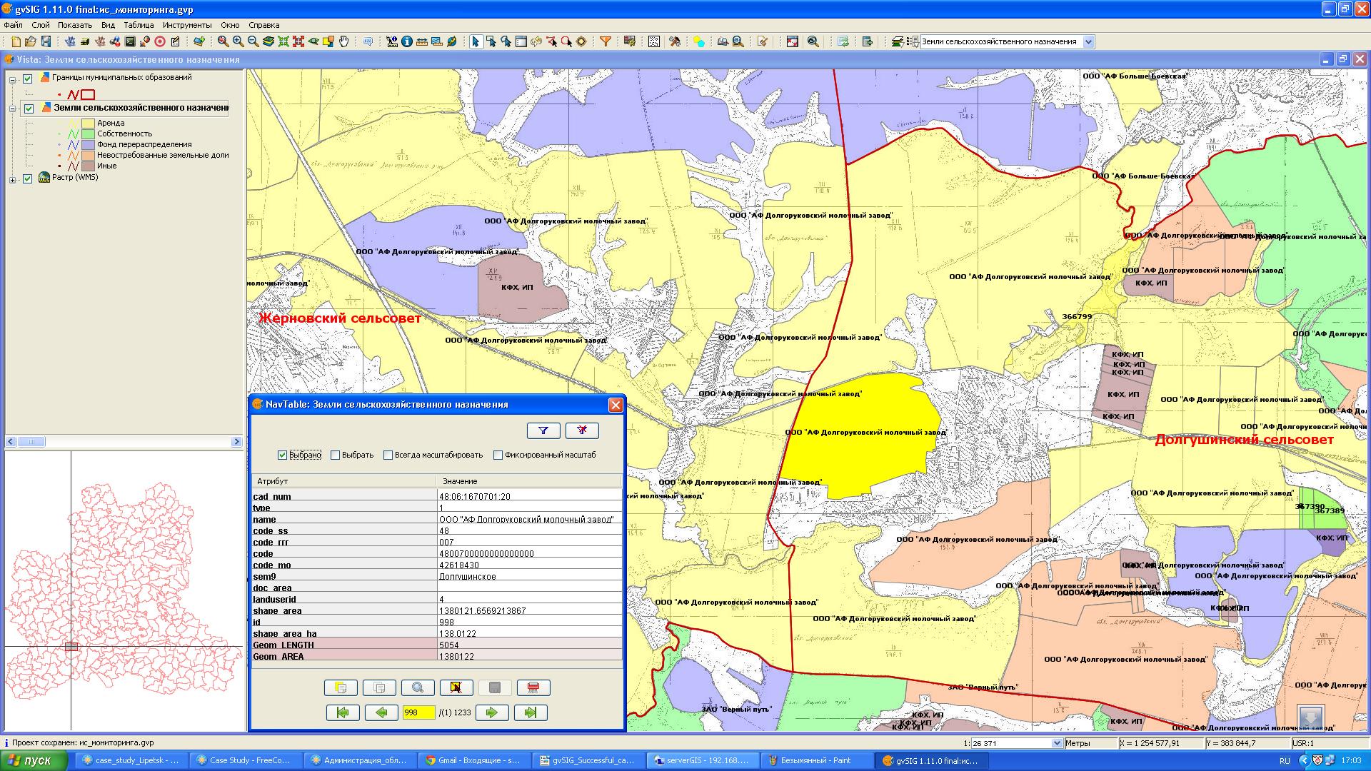
The system provide a centralized approach to the storage of the information about agricultural lands on the central server and support the remote access to display spatial data and generate reports on the base of the developed web mapping application. The central database of the system contains information about agricultural lands on the territories of the 18 municipal districts of the Lipetsk Region. The remote editing of the attributes and geometric characteristics of parcels is doing with the open source GIS gvSIG Desktop and QGIS.
With the web mapping application managers can generate reports on categories of the rural municipalities, types of right and land users, which reflect an actual state of the use of the agricultural lands.
gvSIG Desktop is used as a client geospatial software to create the draft data sets and to edit final spatial data and their attributes in the remote PostGIS database. gvSIG Desktop is also used to the management of the domain tables in the database of the information system.
Extended features of the gvSIG Desktop as SDI client allow developers to build stable and scalable architecture of the information system to update and display data about the agricultural lands using both direct connections to the PostGIS database and WMS / WFS services. Such approach allows us to divide the functionality between different categories of the users and developed suitable workplaces to every user groups.
As a result of using the gvSIG Desktop and other open source software developers were able:
- to provide the information about a current state of the agricultural lands and its use to the managers and specialists of the Lipetsk Regional Administration and administrations of the municipal districts of the Lipetsk Region;
- to build the stable and scalable architecture of the information system with the ability of the following extension without additional expenses on the licensed program products;
- to minimize the total cost of ownership by using the open source software at all stages of the development, deploying and maintenance of the information system.
The information system for the monitoring of turnover of the agricultural lands on the territories of the municipal districts of the Lipetsk Region was developed by specialists of NPO GISIT and Lipetsk State Pedagogical University and became the first regional project in Russian Federation in the field of the management of the agricultural lands which is fully based on the open software and is using successfully in the regional and local administrations.