
gvSIG and the Bétera City Council Planning Department
The Bétera City Council Planning Department creates the Bétera Geographic Information System which purpose is the collection, analysis, maintenance and distribution of municipal information likely to be georeferenced, either alphanumeric or graphic. The main idea is achieve interoperability between public administrations and departments within the municipality located in different buildings and through mobile units.
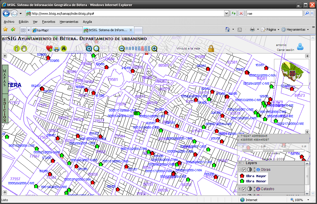
The use of free and open GIS software allows the department to integrate all types of data. gvSIG allows to edit cartography (CAD, SHP, Postgis), upload orthophotos, historical maps or in hard copy (scanned & georeferenced), manage database (Access, Excel, Postgres), relate these data with mobile technology (gvSIG Mobile) and external data sources (WMS). The process ends with the publishing of some data through a web viewer Kamap (Apache, Mapserver, Ajax, Javascript) and WMS services.
Adopted solutions are multiple depending on the availability of data:
- Data available in CAD format:
- They are properly georeferenced and WMS services are generated or they are transformed to shp or postgis format using gvSIG.
- Data available in hard copy:
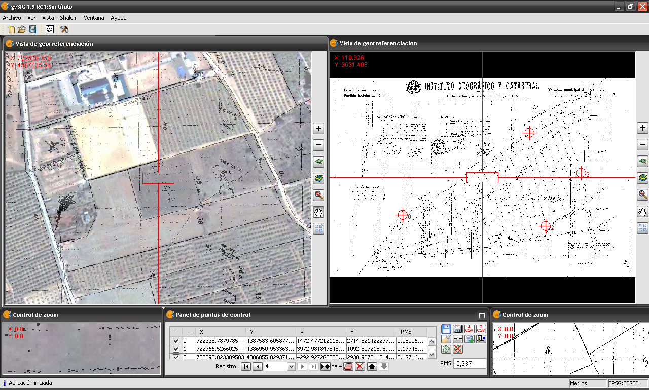
- They are scanned and georeferenced using gvSIG.
- If they are in database format they are associated with corresponding layers that will allowed to link the spatial data with the alphanumeric. For example, the historical database of the cadastre is linked to the corresponding cadastral polygon layer.
- Data available in SHP format:
- They are converted to Postgis for better management over the Internet, allowing table editing.
- Data no available:
- Using traditional surveying and a GPS system connected to the ERVA network from the Valencian Cartographic Institute, obtain centimetre precision of power lines, water supply, housing developments, etc.
- PDA's with gvSIG Mobile can be used to capture less accurate data such as: fords, street lights, containers, road signs, etc.
With all this information a data repository is created to facilitate queries from the Department.
At the same time, several Web maps are generated using Kamap (Apache, Mapserver, Ajax, Postgis, PHP…); a very powerful technology for managing Web services based on user maps. It allows editing of information stored in the City server from anywhere with Internet access.
- Public access to available data in the City Council in compliance with Law 11/2007 regarding citizen's electronic access to public services.
- Local government takes the first steps to comply with Law 14/2010 regarding infrastructure and geographic information services in Spain.
- The system allows access over the Internet to restricted information in different departments across the Council.
- Ability to relate different databases to generate detailed studies. Business licenses, scattered, fords, businesses, cadastral omissions, large and small building permits, calculation of optimal routes in terms of population density, etc.
- Data provided through the Web is updated periodically or in real time so based on the queried layer users are looking at information with the best accuracy available and most up to date.
Contact information:
Antonio García Benlloch - Technical Surveying Engineer
Email: topografo@betera.es
Telephone: (+34) 961600351 extension: 240