
gvSIG and the “Habitat” Federal Program
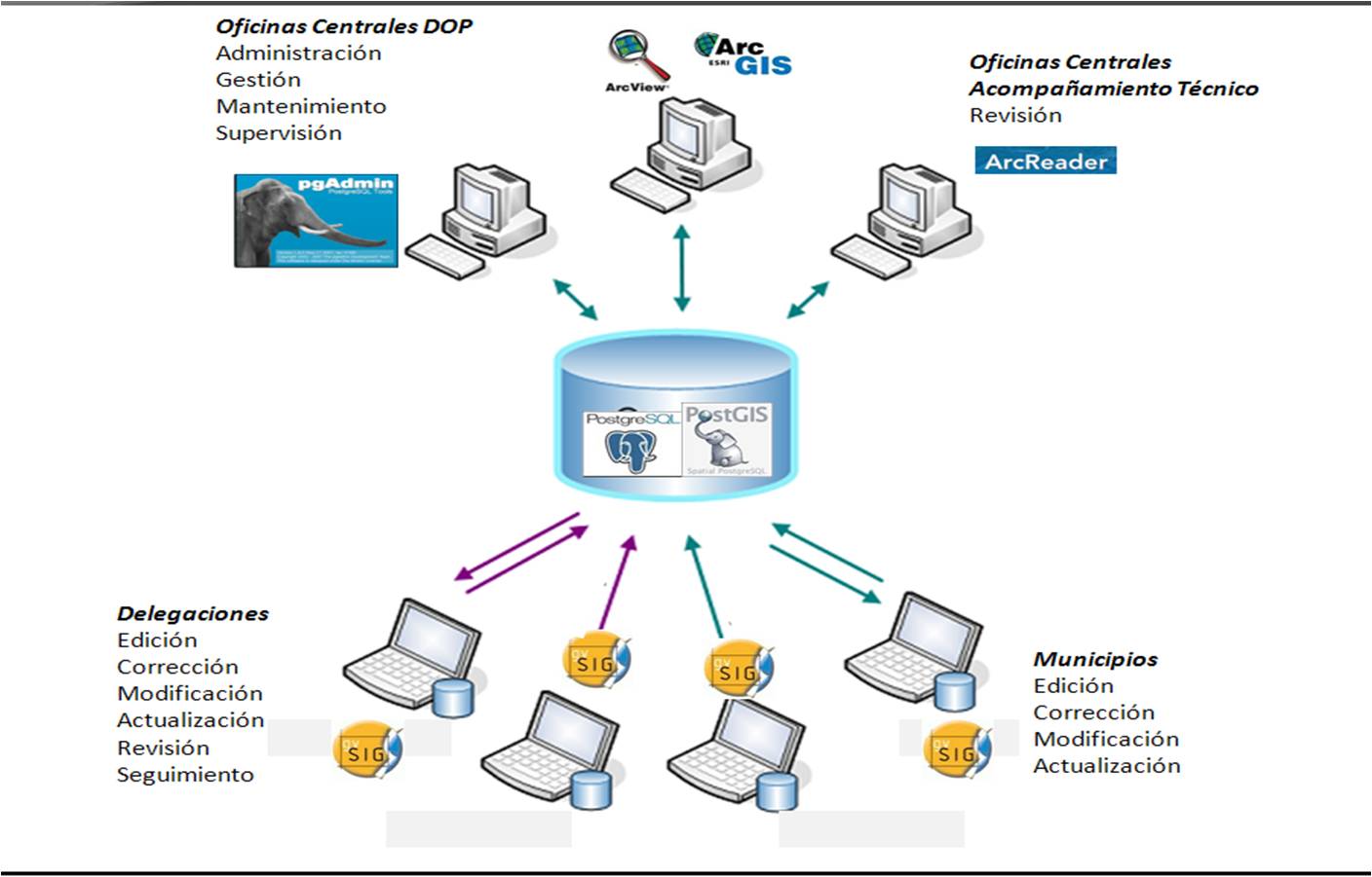
For a good evaluation of the works and actions proposed by municipalities to get federal funding is necessary to have the geographical location of those works with exactness and on time for the various branch offices and central areas of the organization.
Such information is also needed to be shared amongst several agencies and internal departments for evaluation, verification, supervision, follow through and audit.
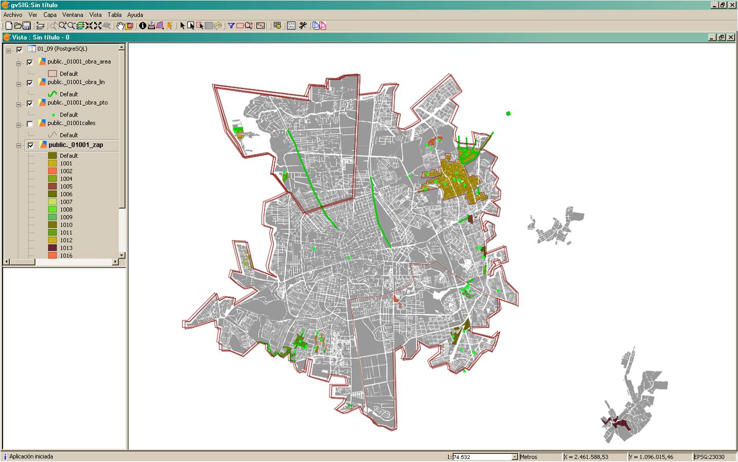
Implementation of a Geodatabase server (PostGres / PostGIS) including base cartography and editable layers for localization of works for internet deploying.
gvSIG as front-end with various customized project files for clients use.
- The works inventory report was standardized amongst all municipalities.
- One centralized cartography for optimal upgrades.
- A single datafile type for information distribution between analysts.
- One user interface for sharing and capture of information.
- A better control for user access to the application.
- A better monitoring of goal achievement.
- A better quality control for georeferenced information.
- A great improvement on the whole approval process for works financing, dramatically reducing the response time for the evaluators.
SEDESOL website: http://www.sedesol.gob.mx/index/index.php
Presentation about the project: http://mapserver.inegi.org.mx/DescargaDocumentosCNGMA2010/docs/DescargaPresentacion?idponentesesion=357&tipoar=nombreppt