
GIS open source framework for an interactive surface and groundwater modelling
The SID&GRID research project, started April 2010 and funded by Regione Toscana (Italy) under the POR FSE 2007-2013, aims to develop a Decision Support System (DSS) defined by a framework based on open source and public domain solutions for the planning and management of the water resource. Today, while some surface hydrological processes are embedded within GIS both commercial and open source, the groundwater modelling processes is not easy to find within geographical code and algorithm.
It will consist in watershed-scale model able to simulate surface and subsurface flow in a three-dimensional domain. The SID&GRID solution will be able to connect the DataBase Management System (DBMS), catchment models and GIS interface by Open Source applications and library, choosing the most effective and efficient integration approach. The outcomes of the project will be available to the final users of the project partnership (e.g. river authorities and water service companies).
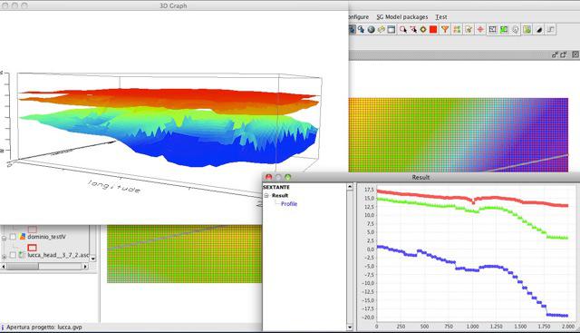
A graphical user interface to manage, analyze and run the SID&GRID hydrological model will be developed within gvSIG desktop; it is thought as a “master control panel” able to guide the user from pre-processing spatial and temporal data to run and analyze the hydrological model outputs. This master control panel will be based on an open source GIS framework and a Spatial Data Infrastructure to share and interoperate with distributed geographical data.
The SID&GRID approach is based on the library Sextante, interfacing with gvSIG GIS. According to this framework, two primary components of the master control panel were identified:
-
A SID&GRID toolbar integrated into gvSIG map context.
-
A new Sextante set of geo-algorithm to pre and post process of spatial data for the hydrological model.
-
A new gvSIG object named “Model” to manage and run the model scenario designed.
The starting idea was to make GIS like a dashboard to pre process, run and post process hydrological data model for surface and subsurface flow .
The SID&GRID goal is to develop not only a new software solution to coupling GIS and hydro model codes, but to design a high-level framework able to address the hydrologist, GIS expert and planner along the main simulation scenario definition.
So the user will be able to define a new model scenario, create and manage database, use specific geoalgorithm to create and manage Model Data Object, write input files for the model engine, run the simulation and (finally) analyze and map model output.
-
Presentation at the 8th International gvSIG Conference