
Environmental and turistic recovery of the abandoned villages of Abruzzo parks
Create a hiking trail that connects the abandoned villages in the Teramo province located inside the National Park of Gran Sasso and Monti della Laga (the largest by extension all over Italy)
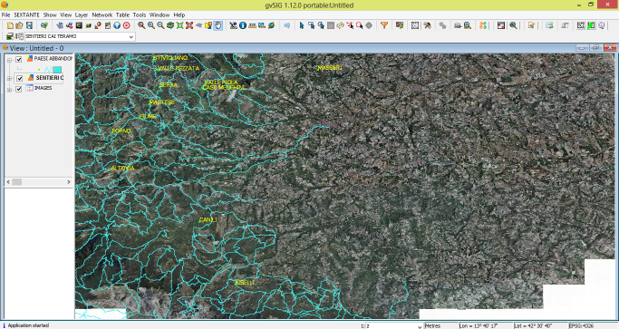
Coordinates of 29 abandoned villages have been collected by GPS and then loaded into a GIS environment together with hiking trails shapefile provided by the CAI of Teramo. Overlaying each single village over the network trails, through algorithms sextante, an origin / destination matrix has been identified to identify possible routes aimed at restoration and enhancement of the abandoned villages. The raster file of the distribution of flora and fauna within the protected area, along with information characterizing individual villages and visibility data derived from DEM open data, enabled a comprehensive classification of the villages surveyed in addition to a comprehensive and easy reading map of the walking path and its environmental features.
Provide services to support hiking tourism, valorisation of social and environmental elements of the Park which will be extended and enhanced through the forthcoming publication of a web service, also for portable devices such as smartphones and tablet, in the National Park of Gran Sasso and Monti della Laga website.
- Project website.
- Presentation at the 10th International Conference