
Definition of a Geographic Area Suitable for Growing Balsa on the Coast of Ecuador
Professionals to the Department of Forestry Development Company INMAIA S.A. have a basic tool for recommending technically the geographic location of their afforestation.
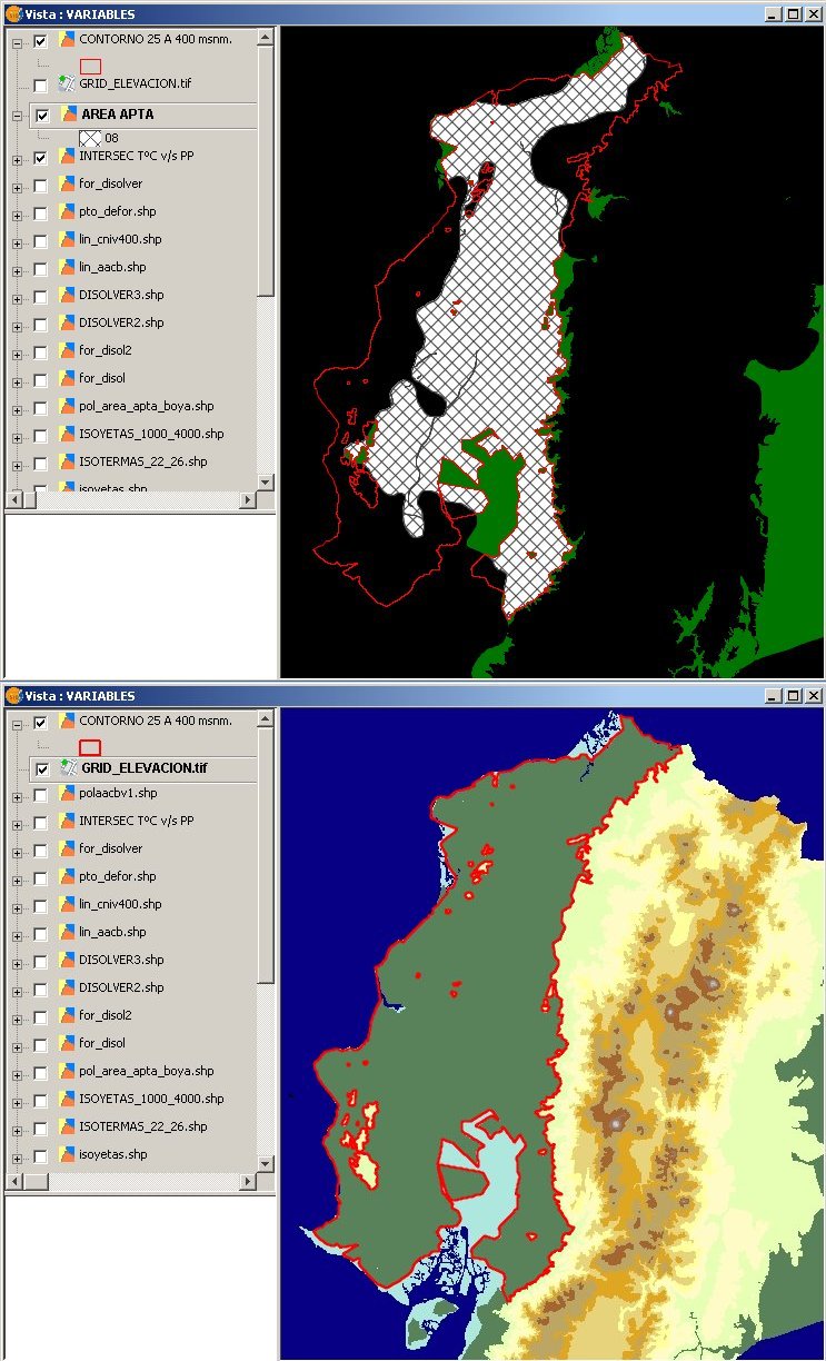
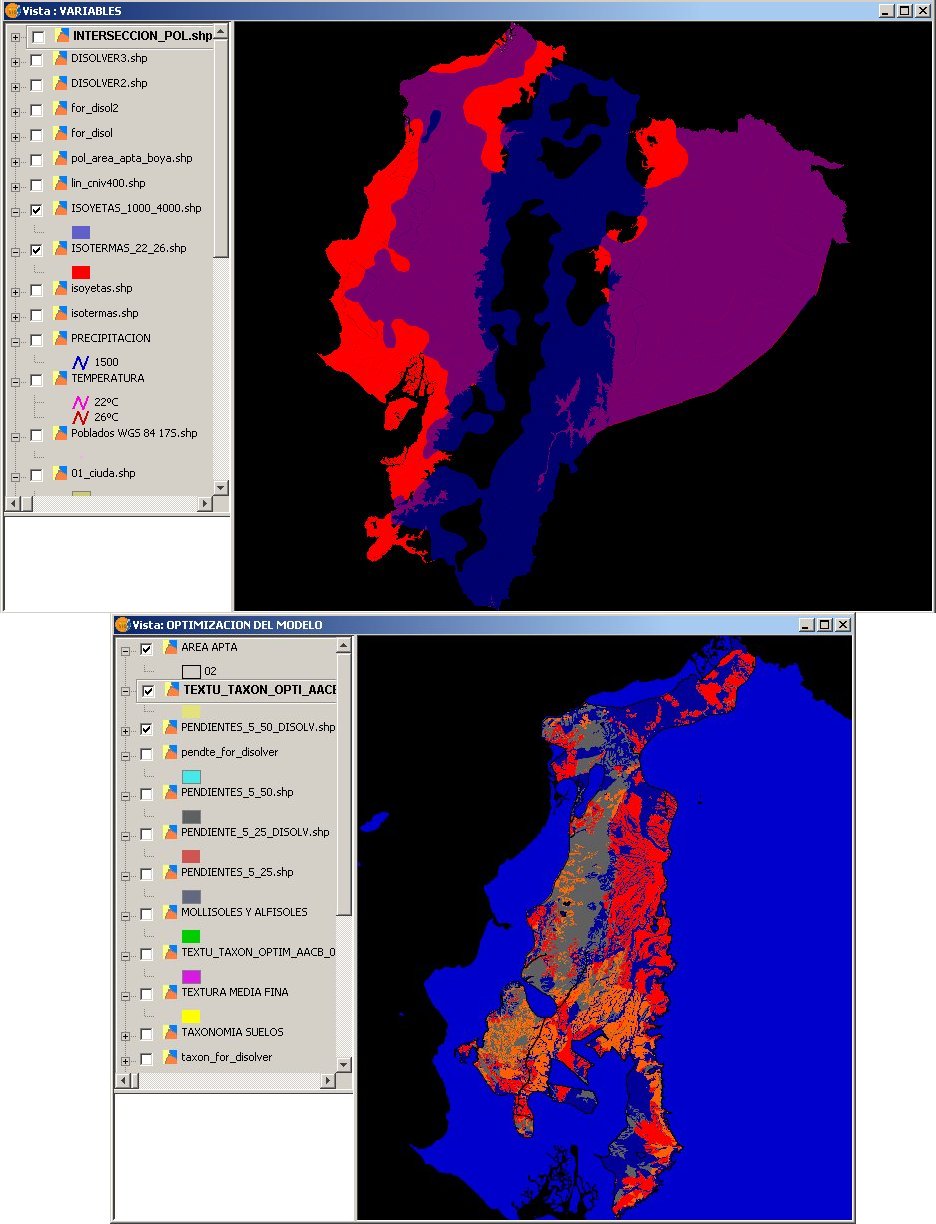
Building a desktop GIS which examines three key agro-climatic variables (temperature (° C) and precipitation (mm) annual average, and altitude relative to mean sea level). A thematic map is derived using the limit values which exist within the climatic conditions suitable for plantation development Balsa.
The professional team of Forest Development Department INMAIA can approximate a technical recommendation on the suitability of a particular location for an afforestation project prior to the inspection of the land.
The data collected during inspections of land can be entered into the GIS to consolidate information while improving the model (feedback). These data were recorded using gvSIG Mobile installed on a GIS data collector.
Savings and optimization of human, material and financial resources. The desktop assessment using thematic map information provided by the GIS, highlight the unsuitability of the location evaluated, so that the afforestation project is discarded without a field visit.
The study is scalable. Can incorporate new variables in more mature stages of the project. Thus, in a second version of the model, significant variables soil were included: texture, slope and taxonomy.