Building business applications above gvSIG: a case study with a bus network management GIS for the Algerian Transport Ministry
This application has been developed by Alkante for the Algerian Transport Ministry under the supervision of the Belgian consulting cabinet Transurb. It aims at helping city bus network managers to structure and optimize their network. As the network managers are not GIS experts at all, the application is to be user-friendly and should allow people :
-
to draw and to update the different components of their network (bus lines, bus stops) using an existing base layer (for example with snapping on a road network),
-
to run spatial analyses of their network in order to quantify the impact of the network with respect to socio-economic criteria (population, area connected...).
The application will be deployed in at least 13 Algerian cities and should also enable managers to complete and update their road base layers as well as to build and print maps of their network.
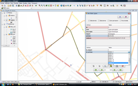
We based our solution on gvSIG (version 1.10) taking advantage of the Sextante binding and of the Navtable extension. It takes the form of a gvSIG extension called “SIG Transport” (GIS for transport), with a devoted menu in the user interface.
The application relies on two main modules :
-
the transport network edition module (for creation and update of network elements such as line and station),
-
the analysis module which uses Sextante map algebra functions to compute area ratio from an impact radius and the geometry of the network.
In particular, the use of the NavTable extension allow managers to use user friendly forms for filling the bus line and the bus station datilled information.
The Sextante algorithms can easily be chained to automatize the analysis process.
The gvSIG installer can be modified to package the application so that it can be installed on every platforms (windows, Linux...) using the gvSIG installer.
The gvSIG software is quite a complete GIS which fulfills more than the basic needs of the bus managers (visualize road networks, draw and edit bus lines and stations, build and print maps, make geospatial analysis on the network...). Furthermore, it can be slightly modified, specialized and combined with other tools (e.g. Sextante) to make its use more user friendly and to adapt it to a particular business.
In our communication, we will discuss this first experience for Alkante of using gvSIG as a basis for embedding a business application. In particular, we plan to detail the context of the project (origin, end users, data availability) and its main objective (functional attempts). We will also discuss our choice of gvSIG regarding this project. Then we propose to give a short feedback of the development process inside gvSIG (technical constraint met, advantages and drawbacks). Last we show the application “in action” using screenshots.
- Presentation at the 7th International gvSIG Conference.
- Poster presented at the 7th International gvSIG Conference.

